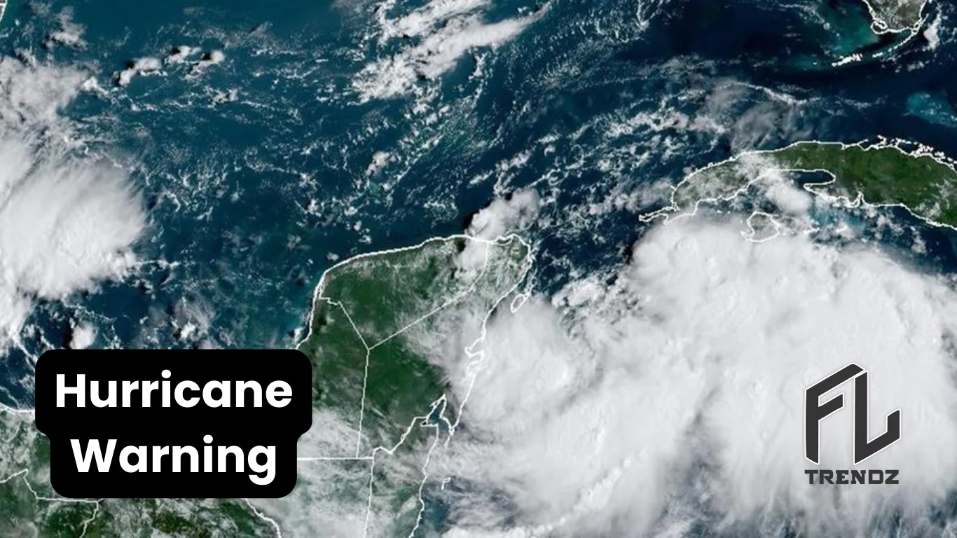
Is there another hurricane after Idalia? Latest Updates On Hurricane Idalia 2023
So far, the Atlantic basin is not being held back by El Niño this hurricane season. It has had two Category 4 cyclones and is keeping meteorologists on their toes with six areas of concern from the Cabo Verde Islands to the Carolinas.

Tropical Storm Jose recently formed, joining Idalia and Franklin, which are still active. The remnants of Gert also reformed into a tropical depression.
Furthermore, Invest 94L off the coast of Africa is expected to become a tropical cyclone soon, and a tropical wave leaving Africa this weekend has a 40% chance of formation over the next seven days.
This period is considered the peak of hurricane season due to the warmest water temperatures and the least wind shear.
Alex DaSilva, a hurricane meteorologist, explains that Invest 94 is likely to move north without causing significant impacts.
The next names on the 2023 hurricane list are Katia and Lee.
When is the end of hurricane season in Florida?
The most occupied part of hurricane season usually runs from around August 20 to early October, peaking on September 10. Historically, the prevalence of Category 3 or higher hurricanes occurs after August 1. However, this season has been unusual in that regard.
2023 Hurricane Names

While there was a quiet month between Hurricane Don and Tropical Storm Gert, 11 named storms have occurred this year. Among them, three turned into hurricanes, and two reached major hurricane status. It’s worth noting that an unnamed storm in January is part of the total count.
By the end of August, a typical year sees around six named storms, with two of them becoming hurricanes and one reaching major hurricane status.
Read Also: It is expected that Idalia will also hit Orlando
However, this year’s hurricane season has been different, and predictions vary on whether it will calm down.

Colorado State University’s two-week forecast, released on Thursday, suggests a 70% chance of above-normal hurricane activity continuing until September 13.
Is there another hurricane after Idalia?
Phil Klotzbach, a hurricane researcher for CSU and lead author of its seasonal hurricane forecast, mentioned that only eight other Atlantic hurricane seasons had 11 or more storms forming by August 31.
There were just six other years in recorded history when two Category 4 storms had formed by August 31. These years include 1933, 1958, 1999, 2004, 2005, and 2010. Franklin reached wind speeds of 150 mph on August 28, just shy of a Category 5 storm, which starts at 157 mph.
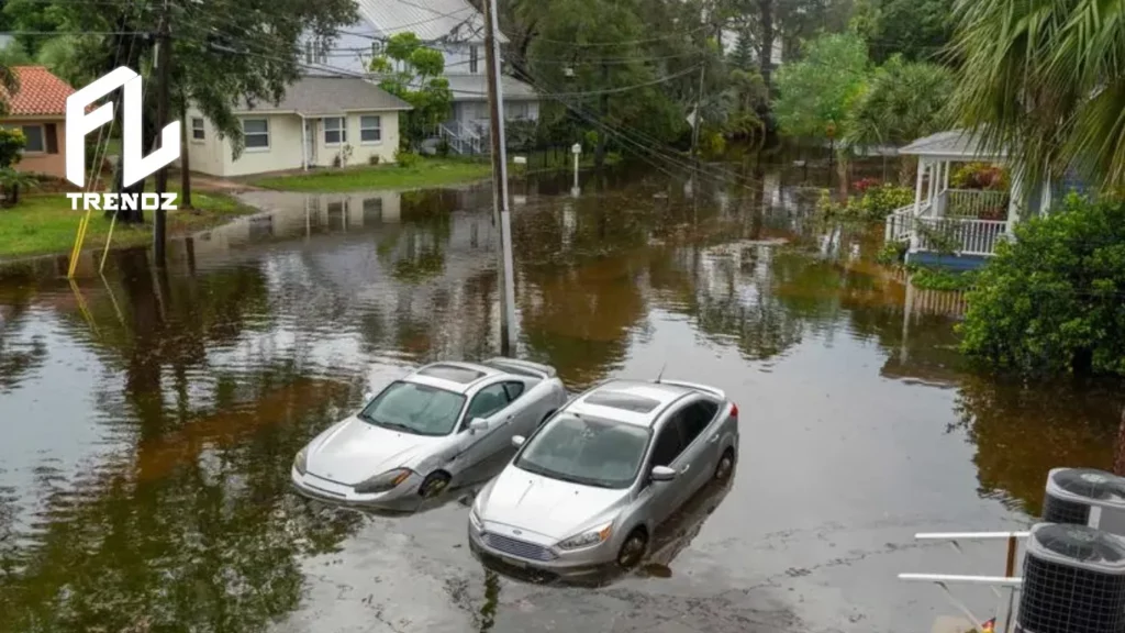
Idalia, on the other hand, had top wind speeds of 130 mph, making it a lower-end Category 4 storm, but its winds decreased to 125 mph right before it made landfall in the Big Bend region of the state at 7:45 a.m. on a Wednesday.
Klotzbach explained that even though 94L will probably head north without causing issues, there’s a tropical wave following it. This wave might enter the main development region with very warm water, providing favorable conditions.
The key factor at play is something called the Madden-Julian Oscillation, or MJO. It’s like a traveling burst of storminess that goes around the world every 30 to 60 days and tends to stir up tropical storms.
Right now, the MJO is in the Pacific, which leads FLTrendz to think there will be fewer storms in the Atlantic. But in contrast, Klotzbach’s forecast from Thursday suggests that the upper-level wind patterns generally support more hurricane activity in the Atlantic and less in the Pacific.
DaSilva explained that the Atlantic’s unusually warm sea surface temperatures are causing storms like Jose to develop, which might not happen in a typical year.
Right now, the Atlantic’s average temperature is around 77.6 degrees, which is warmer than the usual 75 degrees for this time of year. The area around 94L, the storm mentioned earlier, has even warmer sea temperatures, measuring 81 to 82 degrees.
DaSilva anticipates that El Niño will play a more significant role in breaking down storms in the upcoming weeks.
“The big question is, will the sea surface temperatures be able to overcome the wind shear across the basin,” DaSilva said. “We are dealing with these big conflicting factors.”
Idalia, currently a tropical storm in the subtropical Atlantic Ocean, is expected to stick around until at least Wednesday. This will bring heavy surf and a high risk of rip currents in South Florida over the weekend.
There will be showers and thunderstorms on Friday and Saturday.
However, as Idalia’s influence wanes, a front will move through with drier air on Sunday and Monday, thanks to northerly winds.
“There will be no temperature difference, of course; the heat will still be here,” said Chuck Caracozza, a National Weather Service meteorologist in Miami. “But you will notice a difference in the drier air coming in, especially in the second half of the weekend.”
Idalia’s gone, but what’s next in the peak hurricane season?
September 15 is when hurricane season typically peaks. In many years, storm activity is just beginning around this time. Normally, only about 40% of the season’s activity happens before September 1, which is the average date for the first major hurricane to form in a season.
Experts predict that the 2023 Atlantic hurricane season will be busier than usual due to exceptionally warm ocean temperatures. Although there’s an El Niño pattern that might discourage tropical storms by bringing unfavorable high-altitude winds, the belief is that the warm seas will counteract this effect.
Sunrise on #Franklin, #Gert, #Idalia, and #Jose. It's a tad crowded out there. pic.twitter.com/kCh0RJeEGk
— Brian McNoldy (@BMcNoldy) September 1, 2023
Idalia is no longer with us, but it’s still here in a way. It’s become a post-tropical cyclone, which means it’s lost its tropical features and is now powered by jet stream energy. Early Friday, it was around 250 miles west of Bermuda and moving east-southeast at 16 mph.
The storm still has winds of about 60 mph, and there’s a tropical storm watch in place for Bermuda. It’s likely to get weaker in terms of wind, but as it moves over warm ocean waters, it’s expected to regain its full tropical characteristics.
Bermuda can expect around 3 to 5 inches of rain, wind gusts of 40 mph or even higher, and rip currents until Sunday.
Afterward, things become less certain, but there’s a chance that Idalia could change back into a non-tropical storm. It might then move westward and eventually get near the Canadian Maritimes. However, any potential impact there, though currently not very likely, wouldn’t happen until very late next week.
New storms forming
Apart from the existing storms in the Atlantic, there are more systems to keep an eye on for possible development.
A tropical wave that recently appeared off Africa’s coast has a 50% chance of developing in the coming days. If it does, it could head west and potentially pose a threat to the Lesser Antilles or Caribbean.
There’s also a well-organized disturbance northwest of Cabo Verde, which was declared a Tropical Depression on Friday and is expected to become Tropical Storm Katia. However, it’s likely to weaken and dissipate over open waters by Tuesday.
Further east, another strong tropical wave moving from Africa over the weekend is worth watching as it travels west over the Atlantic next week. Some computer models suggest it could become a significant storm.